Author:
Jan Studebaker - Bio.
Jan's Slideshow:
click
here.
Terrain Map: click
here.
Participants: Don
Gettamy, Gracia Coffin,
Cosima Leedom, and Jan Studebaker.
Getting There:
Drive four miles East from Silverton on CO 110 to Howardsville, then
turn right onto FR 589 and drive four miles to Cunningham Gulch.
The trailhead is at the end of the road.
Cosima had been working so hard on both her clients
and her home remodeling projects that she was becoming ill from the
stress of it all. She wisely chose to take a break for a few days
and do something for fun. She knew that getting out for an
adventure was just what she needed, so she asked our good friends,
Don Gettamy and partner Gracia Coffin, to come up with a Colorado
mountain backpack. She wanted to see lots of spring flowers, and
experience the serenity that came with few people and gorgeous
surroundings. Don and Gracia wisely chose the "Highland Mary Lakes"
near Silverton as the destination, and we were off for our
adventure.
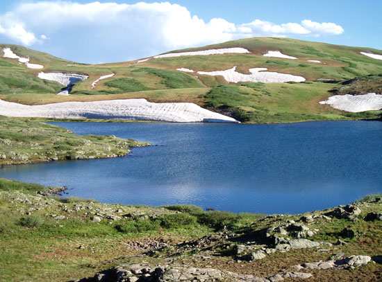
Highland Mary Lake #1, where we
camped for three nights.
The Hike:
The three lakes that make up the "Highland Mary"
group are all above 12,000 feet, which is above tree line. We were
a bit concerned about being out in the open in the sometimes
volatile spring weather (driving rain, wind, and lightning). I was
also concerned that it might be difficult to protect our food from
animals (no place to tie the food out of reach of the critters). As
it turned out, the weather was perfect except for a small bit of
rain on our hike back to the cars on the 4th day, and Don found a
boulder and a high point that provided a decent setting for a
horizontal line to hang our food from. Don didn't use the line
because he kept his food in a light weight metal can that he packed
in.
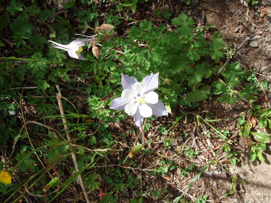
Colorado Columbine, one of many
beautiful varieties in the area.
The "Highland Mary Lakes" are situated just west of
the Continental Divide. However, we discovered on our hikes that
there are dozens of beautiful lakes in the immediate area; they
don't all show up on the maps. Don and I hiked as often as
possible, and the girls would sometimes accompany us. We pretty
much covered the area in two very full days of hiking. Our high
point was 13,259'
Whitehead Peak, from which we had panoramic views
in all directions. We also got within very good visual distance of
Arrow Peak, Vestal Peak, and the Trinity Peaks, all in the nearby
Grenadier Range. Wham Ridge on Vestal was clearly visible. Seeing
those mountains brought back fond memories of climbing all five of
them. I remember well two wonderful trips where we took the
Durango & Silverton Narrow Gauge Railroad from Durango and got off of the train at
Elk Park so that we could more easily backpack into the area for
rock climbing. It was still a very difficult hike, with a gut
wrenching stream crossing.
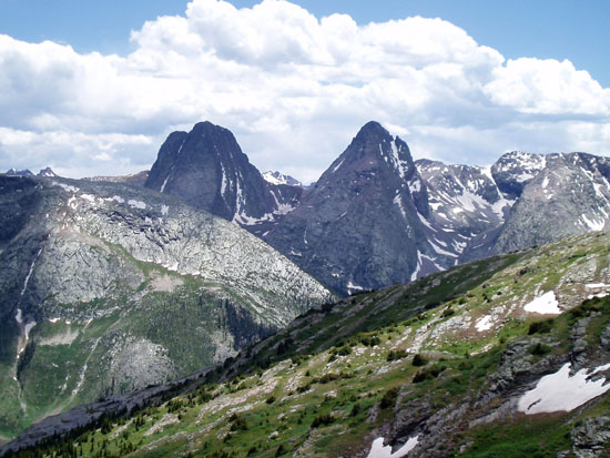
Vestal Peak and Arrow Peak.
We of course hiked to the nearby Verde Lakes, took
easy evening hikes, and photographed many beautiful spring flowers.
Our pace was relaxed and felt very nice indeed. We had the area
almost completely to ourselves, as there were no other campers in
the area, and we saw only 3 or 4 fishermen from a distance. The
trip was exactly what Cosima had in mind, and we all felt that this
could become a yearly trip. We couldn't have had better people to
share the experience with than Don and Gracia......Thanks guys!
Note:
the "Highland Mary Lakes" are described in "100 Classic Hikes in
Colorado", by Scott S. Warren, and is published by The Mountaineers
Books. We highly recommend this book!