Los Alamos Mountaineers
You are here
Splashing down the East Fork of the Jemez (or "Jemez Box Canyon Lite")
Summer visitors are welcome! Some old hands could be really helpful, too.
In brief, this is a hike along the trail paralleling the east fork of the Jemez river, then diverging from the trail and splashing down the river that is in some respects a shallow box canyon. At a pre-determined point we will depart the river and return by the trail paralleling at some distance. This year Zack will be leading from the front (no one can outrun Zack) and Kei will be leading from the rear, that is to say, proceeding at an enjoyable pace and taking in the views.
This will be an approximate repeat of this hike (http://lamountaineers.org/node/203), a 'lite' version of this hike (http://www.wildwestgallery.com/blog/2011/06%20Jemez%20box.htm) , but rather than stopping at the first waterfall we will continue to the bridge Zack spotted a while back and return by land. This more moderate version avoids the need for car-shuttling and assisted descents as chronicled in the latter link (btw, you can interpret Momo's caption "The canyon goes on and on" as "fast forward to the end"--the full hike is a rather long affair). Our memories are vague and inconsistent about the duration of this version so be prepared for 3-4 hours at a moderate pace.
As Bill wrote in the first linked page, be prepared to get wet. I learned the hard way the first time I did this that middle of the summer or not, cotton clothing isn't the best choice. Rubber/plastic sandals are great, sport shoes will work. Hat and sunscreen strongly recommended, water essential, snacks as desired. Many find walking poles helpful.
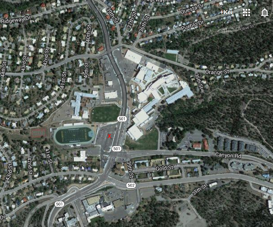
We'll get an early start to avoid the possibility of getting caught in an afternoon storm. Let's plan to depart Sullivan field, carpooling as preferred, at 8:00a.m. sharp Saturday July 11, so plan to get there by 7:45a.m. to get organized and signed in. From there it's 30 minutes' drive (nearly exactly) to the Las Conchas trailhead. Note that if the Las Conchas trailhead parking area is full, at that time of the day there should still be plenty of space just short of there at the Cattle Call Wall climbing area. Sullivan field parking shown with red "x" on this map (http://lamountaineers.org/sites/default/files/uploads/sullivanfield.png), Las Conchas parking areas on this map.
RSVP keidavis00@gmail.com--I'd like some idea of how many people to expect.
- Log in to post comments
Theme by Danetsoft and Danang Probo Sayekti inspired by Maksimer
Comments
Brief trip report
We had 7 LAM members plus 20 students, no injuries other than minor scrapes and blisters, and no one unaccounted for.